We're all familiar with maps. They're those pieces of paper we pull out of the glove compartment — those crispy documents that unfold so large our view of the road is completely obstructed. They make us wish we had go-go-gadget arms that stretched to their widths and two sets of eyes — one focused on the road and one on the plotted path. They make us wish the voice of that woman on the GPS system hadn't led us down a dead-end street.
Different maps serve different purposes. If you're trying to drive from Point A to Point B and prefer a map over GPS instructions, a regular road map is the way to go. But if you've strayed from the road, perhaps on a backpacking trek, you need to see the terrain and the contours of the land. And that means you need to be able to read a topographic map.
Advertisement
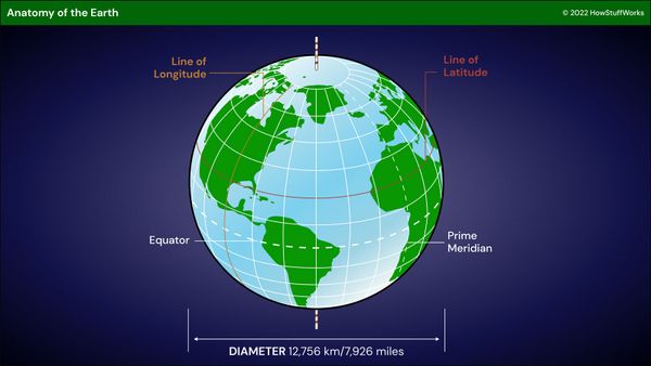
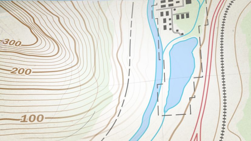
What's the difference between a topographic map and a regular map? In a nutshell, topographic maps allow you to see a three-dimensional landscape on a two-dimensional surface. These maps show the land's contours, elevations, mountains, valleys, bodies of water, vegetation and more. This contour and elevation information distinguishes them from other maps.
The U.S. Geological Survey (USGS) produced its first topographic map in 1879, and it still produces them today. Developments in aerial photography and satellite imaging make these maps much more accurate and efficient to produce than in the days when they were created by hand. When the USGS first started creating maps — which it did to catalog public land — the process was time-consuming and costly. Mule pack train was the only way to reach the mostly unsettled West, and cartographer's tools were crude compared with today's. Mapmakers would find an area's best vantage point — usually the highest point — and climb up to it with drawing boards and sighting devices. Then they would plot their maps, with the features that they could see and measure. This required both skill and daring. The advent of airplanes in the 1940s helped to advance mapping techniques.
Advertisement