Which is better for navigation — compass or GPS?

By: Debra Ronca
Compass and map or GPS device?
Ciaran Griffin/Getty Images

Ch­ri­stopher­­ Columbus. Marco Polo. Sir Walter Raleigh. Ferdinand Magellan. Lewis and Clark. What do these people have in common? Exploration. Setting off from their homelands, these men spent years sailing the oceans and roaming the wild to discover new worlds. Even though there's not much new to discover here on Eart­h today, it's still fun to explore areas that are new to us.

If you want to be an explorer, you need to know how to navigate. The Vikings set out on their ship voyages using only the sun, wind and stars as their guides. Luckily, navigational devices have come a long way since then.

Advertisement

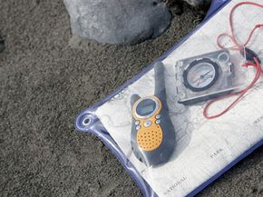
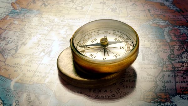
Anyone who's ever been hiking or camping knows that one of the most important items you can carry is a compass. A map is no good to you if you don't h­ave a compass to point you in the right direction. The compass has been around for centuries. To say it is a tried-and-true navigational device would be a gross understatement.

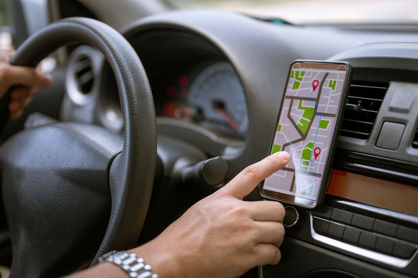
However, in the last few decades, satellite and computer technology opened the door for more advanced personal navigation systems. Global Positioning Systems (GPS) receivers are hand-held devices that not only tell you which direction you're going, but will devise routes for you, as well as provide you with a map. Many GPS devices even come loaded with topographical and trail maps, not just road maps.

It'll make you want to throw your compass and paper maps away. But don't do that just yet. Each instrument has as list of pros and cons you should consider. Let's take a look at compass vs. GPS.

Advertisement

Using a Compass

A good old-fashioned compass and a map can guide your way.
Noel Hendrickson/Getty Images

Here's the most important thing you need to know about a compass: There's no point in having one if you don't know how to use it. Your compass should come with directions on how to use it. Read them.

Because the needle of a compass is magnetized, it will always point toward magnetic north. You can use a compass without a map, if you just need to go in a very general direction in a straight line. But when you're in the wilderness seeking out a specific destination, you'll need a little more direction than that.

Advertisement

Pairing your compass with your map will give you more accuracy. It'll also alert you to any areas you won't be able to cross straight through, such as a river or a canyon. A map gives you directions, and a compass enables you to follow them. It's best to utilize a topographic map when hiking and exploring.

If you know where you are on the map but you don't know how to get to your destination, use your compass to take a bearing. Your compass lets you assign a numerical direction -- a bearing -- to any direction in the full 360-degree circle around you. This is important because, with a bearing, you can travel toward a specific spot instead of just in a general direction. Here's how to set a bearing. Your compass has a rotating ring around it. You'll see the ring is divided in increments that add up to 360 degrees. Align your map and compass both North, and place your compass over your location on the map. Imagine or draw a straight line from the compass center to your destination. The travel line on your compass will show a bearing number. Following that exact bearing will take you to your exact target on the map.

Advertisement

Magnetic North vs True North

Once you've set your bearing, you're on the right track to finding your way. But there's still another wrinkle. ­Magnetic north isn't the same as true north -- it's close, but no cigar. Magnetic north is always moving, and we call this margin of error declination. Declination is an angle that measures the difference between true north and magnetic north. The angle varies depending on where you are on the planet. This is why it's important to always use a current map when you're in unfamiliar territory, especially when you're trekking long distances. With short distances, the declination may only be 100 feet (30 meters) or so. But when you're trekking long distances, the margin of error could be several miles (or kilometers). Your map will tell you the declination. When you make your navigation calculations, you add or subtract that angle from the compass bearing numbers. Some compasses only require you to make that adjustment once for your entire trip -- check your compass instructions for more about setting the declination.

Again, learning to read a compass and topographical map requires preparation and skill. Read the instructions that came with your compass, check your library, outdoor gear store or search for a tutorial online. Try doing a practice run at home before you go out in unfamiliar backcountry.

Advertisement

If using a compass requires so much calculation and skill, would a GPS make things any easier? Find out on the next page.

GPS Basics

A GPS receiver will tell you where you are and provide you with a route to your destination.
Thomas Barwick/Getty Images

Global Po­sitioning System (GPS) devices are a relatively new navigation invention, considering we've been using compasses and maps for hundreds of years. Used by the military for years, the government opened up GPS satellites for civilian use in the 1980s.

A network of 24 satellites orbits the Earth twice a day, transmitting signals back to earth. A GPS receiver locks onto signals from three or more satellites to determine your location, using a method called trilateration. Your receiver calculates the difference between the time a satellite sent a signal and the time your system received it. Using the information gathered from several signals, the receiver triangulates your exact position. It can even determine how fast you're going and how long it will take you to reach your destination. GPS receivers are extremely accurate, many within 50 feet (15 meters) [source: Garmin].

Advertisement

Many GPS devices come loaded with maps that work in conjunction with the information from the satellite signal. Depending on the particular GPS unit you purchase, your device could come with road maps, marine maps, topographic maps, trail maps or ski resort maps. Keep in mind there are different GPS units for road travel, cycling, running and fitness, boating, fishing, flying and hiking. If your unit isn't loaded with the maps you want, you can purchase and download specific maps to the device. Maps vary widely in price. You can find some maps (like maps of national parks) online for free, or you can purchase device-specific maps from the manufacturer for around $100.

You're probably familiar with using a GPS system in your car. Simply enter an address and the device will calculate a route there and a route home. Some systems will even take into account traffic and construction conditions. But how does a GPS steer you in the wilderness?

Advertisement

Using GPS

using GPS.jpg
Male driver searching location using GPS navigation in mobile phone before driving car. simon2579 / Getty Images

A GPS receiver provides you with your location, distance/directions, routes and tracking. Tracking means that the GPS unit will provide you with a breadcrumb trail, in case you need to retrace your steps. You'll likely need to initialize and configure your GPS device before you can use it. This means acquiring a signal from the satellites. If your signal is weak or the system can't find enough satellites, then you shouldn't rely on the device for directions. A clear sky with few obstacles between you and it is the best for a strong signal. This may be difficult if you're under heavy forest canopy.

Program your GPS device using coordinates from your map. Set waypoints along the way -- starting with where you parked your car and ending with your campsite. These waypoints will build your route. You can learn how to do this by reading the instruction manual that came with the device. Obviously, you'll also need to know how to read a map. Practice at home before taking your GPS device out into unfamiliar terrain. Your local outdoor supply store may offer helpful courses on how to use a GPS device, as well as basic navigational skills.

Advertisement

It's important to remember that a GPS unit doesn't replace a map and compass. A compass won't run out of batteries, and a map will never lose its signal. Think of your GPS unit as a companion to your compass and map. And remember, the unit is only as good as the map you use along with it. Experts agree the best maps to use are the USGS Topographic Maps, which are accurate and frequently updated. Your GPS unit should also have an electronic compass.

­But we still haven't answered the question: Which is the better navigational device -- compass or GPS?

Advertisement

Compass vs GPS — the Pros and the Cons

In order to determine which is better -- compass or GPS -- we need to t­ake a good look ­at the pros and cons of each. First, let's check out the pros and cons of the compass.

Pros:

Advertisement

  • It's a lightweight, pocket-sized device -- perfect for when you need to travel light.
  • It's inexpensive. You can buy a basic compass for around $10.
  • It needs no external power to operate. You take it out of the box, and it's good to go.
  • In fact, a compass is so simple, you can make one yourself with stuff you probably have in your own home.

Cons:

  • You need to learn a few skills in order to read a compass properly. Most people know they should always carry a compass, but do they all know how to actually use it?
  • Without a map, a compass really only shows you north, and that's it.
  • If you're completely lost and don't know where anything is, your compass may not be useful all.

Now, let's check out the pros and cons of GPS:

Pros:

  • You can carry a huge variety of maps in the palm of your hand. The unit will pinpoint exactly where you are on the map.
  • The electronic compass is easier to use than a traditional compass when you're on the move. The GPS unit will let you know how much distance you've covered and how much further you have to go.
  • It will even tell you your altitude.

Cons:

  • A GPS unit runs on batteries. What if they run out? You can always carry extras, but that's adding extra weight to your pack.
  • A GPS unit is an electronic device -- it can break or stop working if you drop it or if it gets wet.
  • GPS units are expensive. A basic unit will cost around $100, and the more advanced ones can run upward of $350.
  • It requires a strong signal to work accurately. It won't receive a signal inside most buildings or in caves and sometimes under heavy forest canopy or even just a cloudy day.

Final conclusion: A GPS unit may provide you with much more detailed navigational information than you could ever get with a compass. But because it relies on battery power and a clear signal, any trekker should always hike with a good old-fashioned compass and a map, as well.

Advertisement

Lots More Information

Related H­owStuffWorks Articles

More Great Links

  • Berger, Karen. "What are the pros and cons of taking a GPS unit on a hike?" GORP.com. 2009. (Feb. 26, 2009) http://gorp.away.com/gorp/activity/hiking/expert/exp071801.htm
  • Brain, Marshall, and Tom Harris. "How GPS Receivers Work." HowStuffWorks.com. Sept. 25, 2006. (Feb. 26, 2009)https://electronics.howstuffworks.com/gadgets/travel/gps.htm
  • Curtis, Rick. "OA Guide to Map & Compass - Part 1." The Backpacker's Field Manual. 1998. (Feb. 26, 2009) http://www.princeton.edu/~oa/manual/mapcompass.shtml
  • Diaz, Jesus. "Nokia 6210 Navigator Keeps Pedestrians on Course with Compass, Accelerometers." Gizmodo. Feb. 11, 2008. (Feb. 26, 2009)http://gizmodo.com/354769/
  • Garmin. "GPS Beginner's Guide." Garmin.com. July 2008. (Feb. 26, 2009) http://www8.garmin.com/manuals/GPSGuideforBeginners_Manual.pdf
  • Garmin. "What is GPS?" Garmin.com. 2009. (Feb. 26, 2009)http://www8.garmin.com/aboutGPS/
  • HowStuffWorks.com. "History of the Vikings and Navigation." 2009. (Feb. 26, 2009) https://videos.howstuffworks.com/nasa/2034-how-the-vikings-navigated-the-atlantic-ocean-video.htm
  • Magellan. "GPS In Action." Magellan.com. 2009. (Feb. 26, 2009)http://www.magellangps.com/products/GPSInAction.asp
  • National Space-Based Positioning, Navigation, and Timing Coordination Office. "Global Positioning System." USA.gov. 2009. (Feb. 26, 2009)http://www.gps.gov/
  • REI Expert Advice. "More About Compasses." REI.com. 2009. (Mar. 1, 2009) http://www.rei.com/expertadvice/articles/compass+navigation.html
  • Robison, Ed. "How to Use Your New GPS Receiver." REI.com. 2009. (Feb. 26, 2009) http://www.rei.com/expertadvice/articles/gps+receiver+howto.html
  • Wilson, Ron and Kalinowski, Andrew. "Maps, Compasses, & GPS's 101: A Basic Course." GPSNuts.com. 2009. (Feb. 26, 2009)http://www.gpsnuts.com/myGPS/GPS/Tutorials/Maps/maps.htm

Advertisement

Loading...