It's a blast furnace of an avenue that only Lucifer and his minions could truly love. It's the Camino del Diablo — the Devil's Highway — a sun-scorched dirt road in Arizona with a deadly history, one that you can tackle yourself — if you're not scared off by the path's devilish reputation and sad lore.
Located just west of the small town of Ajo, the Devil's Highway traverses parts of Organ Pipe National Monument, Cabeza Prieta National Wildlife Refuge, and (somewhat dangerously) the Barry M. Goldwater bombing range, in a lonely stretch of the Sonoran Desert.
Advertisement
The path's roots stretch back perhaps 1,000 years ago, when Native Americans used the roughly 130-mile (209-kilometer) road to cross the barren land. Then, starting in the mid-1500s, European explorers, settlers, traders and missionaries braved the trail as a route between Sonoyta, Mexico and Yuma, Arizona, often as a part of the trip to and from the California area.
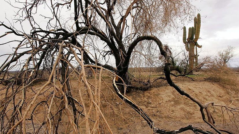
But the path, which was also called the Camino del Muerto ("Road of the Dead") was no leisurely trip. Travelers were beset by lack of water, venomous fauna like rattlesnakes, thorny cacti, hostile locals, and most of all, the unrelenting, soul-sucking heat, which can soar to 120 degrees Fahrenheit (49 Celsius) in summertime, cooking the dusty ground to temperatures that are far higher.
The "highway" claimed so many lives that perhaps 2,000 people perished in the latter half of the 1800s alone. Even today, it's not hard to find graves alongside the road, a sad testament to the travelers who have died trying to cross the desert. Nowadays, they are more likely to be migrants from Mexico. A shorter route was faster and lessened some of the hazards, but notably offered less access to tinajas, the natural water catchments hidden away in the dusty landscape.
In 1870, traffic along the Devil's Highway plummeted, not due to the incredible number of fatalities, but because a railroad in the area made the dangers of the trail unnecessary. In 1978, the road was listed on the National Register of Historic Places for its significance on the western frontier.
Today, the area is nearly as empty and devoid of human life as it was in the 19th century. The dearth of civilization is largely because so much of the local land is already controlled by Native American tribes or owned by the federal government, leaving little room for infrastructure development.
Economic factors play a role in the lack of people, too. "The town [Ajo] was known for many years for its copper mine that was closed in 1985," says Alfredo Soto, a wildlife refuge specialist with the U.S. Fish & Wildlife Service at Cabeza Prieta National Wildlife Refuge, in an email interview. "The town is rather small and unlikely to grow much especially because the surrounding area is federally owned or tribal land. It makes for a crunch in land."
As such, the sun-blistered land may as well be owned by the devil himself. Yet it has a beauty of its own that attracts intrepid travelers.
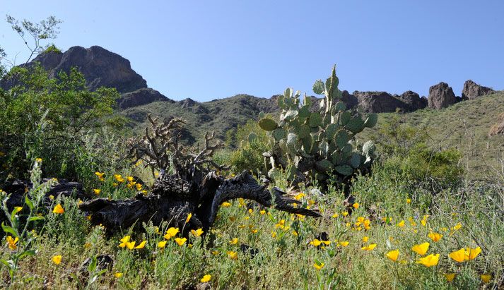
"Contrary to images of deserts as lifeless wastelands, I found myself crossing a spectacularly complex ecosystem," wrote Michael Benanav of his Devil's Highway trip in The New York Times. "The Sonoran is the most biodiverse desert in the world. This section of it alone is home to more than 275 animal species (not counting insects), and some 400 types of plants, including the saguaro cactus. Perhaps the most likable member of the plant kingdom, each saguaro appears to have a unique personality."
The 860,000 acre (348,000 hectare) Cabeza Prieta National Wildlife Refuge teems with wildflowers in the spring and is a sanctuary for the endangered big horn sheep and the Sonoran pronghorn, a deer-like animal that once was very common in America. Another attraction is the Pinacate Lava Flow, a "Mexican lava flow that makes its way into the United States in this one particular location in the middle of the road that goes through the refuge," Soto says. "Although lava rock is common throughout the area outside of the lava flow, the transition from sand to dark lava rock to sand again is beautiful and worth some extra hiking and visiting."
Advertisement